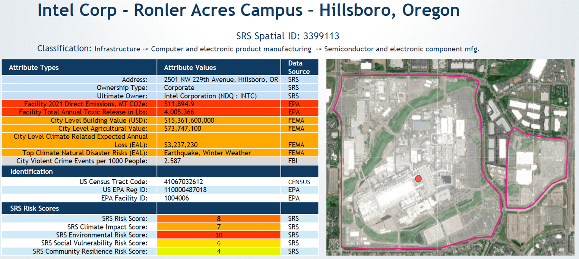
Corporate Asset Class
With over 8,000 Public and Private Issuers, 570,000 asset locations. SRS provides a turn-key solution illuminating hundreds of key factors for both Corporate Level and Facility Level Spatial Factors for use in Portfolio Analytics, Fundamental Research, and Credit/Risk Analysis
- Climate/Physical Risks
- Facility-Level GHG Emissions
- Environmental Conditions
- Socio-Economic Conditions
- Historical Weather Events
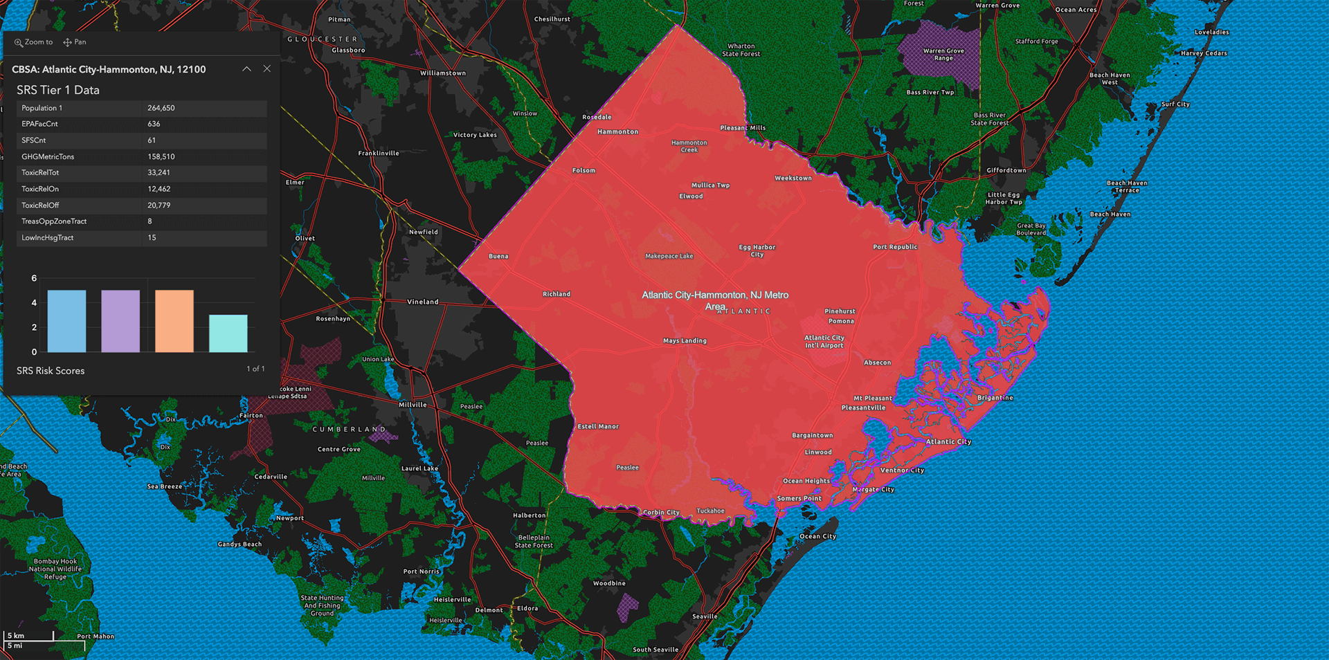
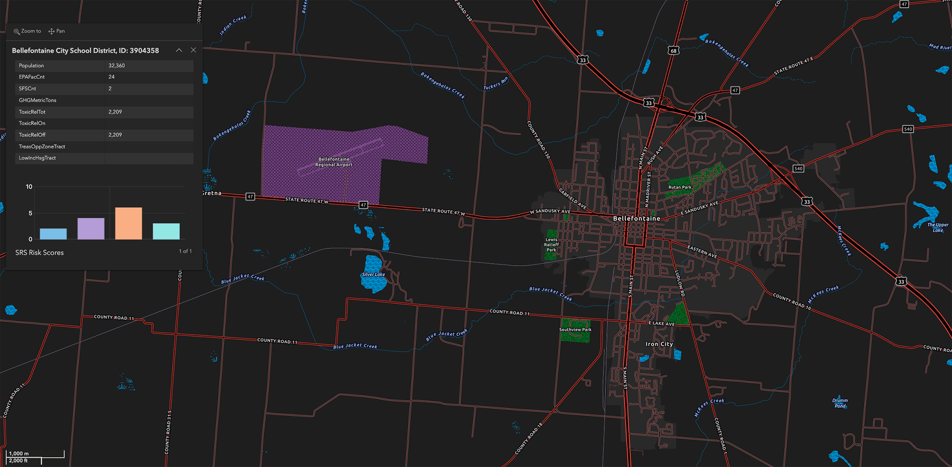
US Municipal Asset Class
18,000 Issuers, 1.1 million securities.
Insurance
Comprehensive data solution for underwriters, brokers, and carbon credit trading.
• Weather Event: Texas : Wind : 19950505-19950505 : $2220.0 M• Weather Event: Florida : Tornado : 19930312-19930313 : $3134.9 M• Weather Event: Texas : Tornado : 19700511-19700511 : $1820.9 M• Weather Event: Ohio : Tornado : 19740403-19740403 : $1464.3 M• Weather Event: Nebraska : Tornado : 19750506-19750506 : $1321.2 M• Weather Event: Michigan : Tornado : 19650411-19650411 : $2238.4 M• Weather Event: Massachusetts : Tornado : 19530609-19530609 : $2622.7 M• Weather Event: Louisiana : Tornado : 19781203-19781203 : $1038.2 M• Weather Event: Kansas : Tornado : 19660608-19660608 : $2169.3 M• Weather Event: Indiana : Tornado : 19740403-19740403 : $1464.3 M
Supply Chain
Model Impacts of Real-Time Weather and Political Events on Asset Locations, Supply Chains, and Commodities
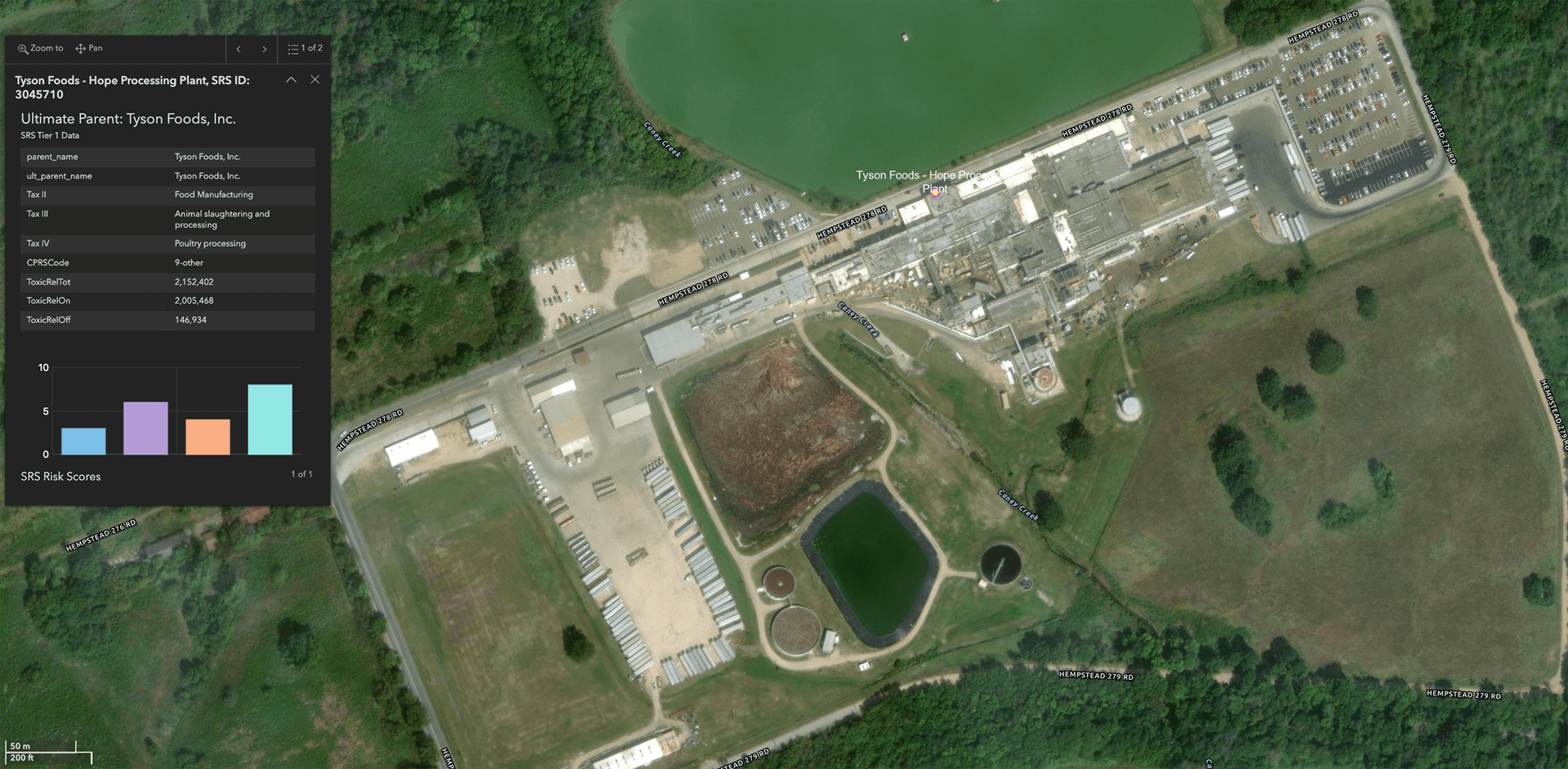
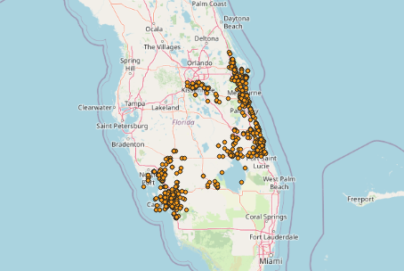
Hurricane Ian (2022) - Key infrastructure assets potentially impacted by the storm path
Financial Institution Stress Testing
SRS spatial-level knowledge graph solution provides a comprehensive picture Physical Risk Exposures, Environmental Impacts, Expected Annnual Losses, and weather event history with $ damages back to 1950.
- CECL (Current Expected Credit Losses)
- CCAR (Comprehensive Capital Analysis and Review)
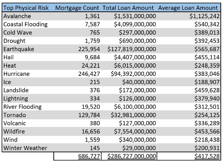
Major US Bank – (2018-2022) Census tract level mortgage originations aggregated by top physical risks.
Real Estate Development | Investing
SRS’s spatial-level knowledge graph provides a simple turn-key solution for anyone involved in real estate develop, investing and site selection to connect thousands of spatial level attributes with a specific point on the map.
Climate
o Top Physical Risks
o Expected Annual Losses
o Storm Event History
Environmental
o GHG/Carbon Emissions
o Toxic Release
o Air Quality
o Water Quality
o Proximity to Potential Hazards
Socio-Economic
o Population/Age
o Income/Poverty
o Education
o Key Health Indicators
Mobility
AI Training Data Sets
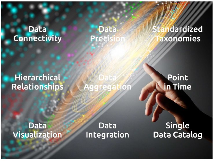
Much has been written about how knowledge graphs are foundational to AI, Large Language Models, and generative AI. In SRS’ spatial-level knowledge graph where ever data point is connected to any other data point is a major source for fact based training sets. No fabricated data. Real Facts.
- Climate
- Environmental
- Socio-Economic
- Facility Location, Function and Ownership